Warning: max(): Array must contain at least one element in /var/www/web829/html/wp-content/plugins/wp-gpx-maps/wp-gpx-maps-utils.php on line 391
Warning: min(): Array must contain at least one element in /var/www/web829/html/wp-content/plugins/wp-gpx-maps/wp-gpx-maps-utils.php on line 392
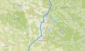
Auf 61 km führt der größtenteils über eine ehemalige Bahnstrecke verlaufende Radweg von Nabburg über Oberviechtach und Schönsee bis an die tschechische Grenze. Von dort aus kann man bis Horšovský Týn weiterfahren.
Gesamtstrecke: 61.43 km
Maximale Höhe: 756 m
Minimale Höhe: 345 m
Download file: Bayerisch-Böhmischer Freundschaftsweg.gpx
Maximale Höhe: 756 m
Minimale Höhe: 345 m